Otherwise, please select your country below so we can display the correct prices, delivery times and delivery costs for your location.
product
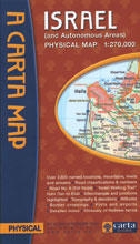
https://www.judaicawebstore.com/-cartas-physical-map-of-israel-and-autonomous-areas-p140784302 Carta's Physical Map of Israel (and Autonomous Areas)https://www.judaicawebstore.com/media/catalog/product/C/a/Carta-s-Physical-Map-of-Israel-and-Autonomous-Areas_large.jpg10.9510.95USDOutOfStock/Judaica/Jewish Books/Israel Maps & Guides3692 <P>60 X 90 cm (24x35½ in.), folds to 13.5 x 23.5 cm (5¼x9¼ in.); scale 1:270,000</P>
<P>- Over 3,500 named locations, mountains, rivers and streams.<BR>- Road classifications & numbers.<BR>- Road No. 6 (Toll Road).<BR>- "Israel Walking Trail" from Dan to Eilat.<BR>- Interchanges and junctions highlighted.<BR>- Topography & elevations - Altitudes - Border crossings - Ports and airports.<BR>- Detailed index - Glossary of Hebrew terms </P>
00add-to-cartCarta